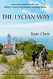
The Lycian Way (Likia Yolu) Topographic Map Atlas with Index 1:50000 Complete Hiking/Walking Map Turkey Fethiye - Antalya Mt. Olympos (Tahtali), Kinik ... Map (Travel Guide Trail Maps of Turkey)
Product Description
The Lycian Way (Likia Yolu) Topographic Map Atlas with Index 1:50000 Complete Hiking/Walking Map Turkey Fethiye - Antalya Mt. Olympos (Tahtali), Kinik ... Map (Travel Guide Trail Maps of Turkey)
Detailed topographic map 1:50.000 & 20 meter contours for hiking and trekking, printed as an atlas book (with overlapping pages).
Complete map of a popular version of the famous Lycian Way hiking trail in southwest Turkey. The approx. 540-km long trail runs along the Mediterranean coast of Turkey, connecting the town of Fethiye in the west with the village of Geyikbayırı, close to Antalya, in the east. The route as shown in the Atlas includes the trails from Fethiye through the ghost Greek village of Kayaköy in the west and the latest extension from Hisarçandır to Geyikbayırı in the east.
The Index makes it easy to find all cities, towns and villages along the route and nearby, as well as prominent tourist attractions, historic and archeological sites, ruins, temples etc.
20 meter contour lines, road network, trails & paths, transportation, food, campsites, shelters, guest houses & hotels.
The map scale of 1:50000 (1 cm = 500 meters) provides a wealth of detail while keeping low the weight of the atlas itself. The large page format of 8.5x11in minimizes page count and along with an overlapping map design allows for comfortable navigation.
The details included in the topographic maps of this atlas were specifically selected to be useful for trekkers, hikers and walkers of all interests, and make it easy to plan and enjoy both short excursions and hikes as well as long multi-day adventures along the main marked routes and/or adjacent trails and paths, which are also shown on the maps.
With this ultralight atlas you will always have a detailed, reliable, information-rich, battery-independent, shatter-proof map for your adventure.