

Sky High Bull's-Eye (24"x24") Drone Ground Control Point GCP - UAV Aerial Target for Mapping & Surveying (6 Pack) | Center Passthrough (Black/White Markers) | Pix4D & DroneDeploy Compatible
Product Description
Sky High Bull's-Eye (24"x24") Drone Ground Control Point GCP - UAV Aerial Target for Mapping & Surveying (6 Pack) | Center Passthrough (Black/White Markers) | Pix4D & DroneDeploy Compatible
- 24”x24” AERIAL TARGETS - Designed for low to medium altitude drone mapping and scanning, these drone GCPs were made for drone mapping up to 400 feet. The standard 24”x24” size is useful when scaling and verifying the map, providing a standard reference distance during post-processing.
- DRONE GCP WITH CENTER PASSTHROUGH - The center passthrough design allows pre-established survey stakes or survey markers to be slid directly through the GCP. A surveyor can place markers days or weeks prior to the flight, then place the aerial target over the existing marker without moving it.
- LIGHTWEIGHT & DURABLE AERIAL TARGETS - Using a weatherproof mesh material, these aerial targets were made to be highly visible yet lightweight, a big benefit when traveling or placing the ground control points in the field. The material is made with a matte finish which reduces glare from sunlight and overexposure on sunny days.
- WORKS WITH LEADING PHOTOGRAMMETRY SOFTWARE - Pix4D, DroneDeploy, Metashape, OpenDroneMap/WebODM, UAV4GEO Lightning, DJI Terra, Esri Drone2Map, Bentley ContextCapture, SimActive Correlator3D, 3Dsurvey, Propeller, Global Mapper Pro & RealityCapture
- UAV GCP WITH CORNER ANCHOR POINTS - With eyelets at each corner to easily anchor the aerial targets, the corner anchor points prevent the GCPs from moving during mapping. The anchors also allow the GCPs to be left in the field if needed for repeat flights.
Finally a better alternative to homemade Ground Control Points (GCPs) to fulfill any UAV drone mapper's needs. With a unique center passthrough design, this GCP can be used on already established survey points, which enables mapping to be performed after a surveyor has already taken coordinates. Simply place the survey marker through the 3" x 3" center cutout of the GCP to perform precise aerial mapping with pre-established coordinates. The GCP can also be used via a more traditional approach with the center flaps covering the cutout, enabling centimeter level precision mapping. The cutout flaps provides a center point to shoot your own coordinates, with an open center to place your rod, decreasing the chances of puncturing the GCP. The 24" x 24" design enables easy transport and storage of the GCPs as well as a scale to use when reconstructing your map. With 4 tie down points, the GCP is also easy to keep in position, even on the windiest of days.
Technical Specifications
You might also like
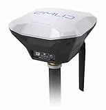
Reach RS+ RTK GNSS Receiver with an App as a Controller
Remote Pilot Test Prep 2019: Study & Prepare: Pass your test and know what is essential to safely operate an unmanned aircraft – from the most trusted source in aviation training (Test Prep Series)

Drones Landing Pad,Homga Universal Waterproof D 75cm/30'' Portable Foldable Landing Pads for RC Drones Helicopter, PVB Drones, DJI Mavic Pro Phantom 2/3/4/ Pro, Antel Robotic, 3DR Solo (Landing pad)
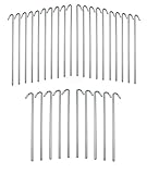
IIT 71021 9 inch 30-Piece Galvanized Steel Tent Pegs-Garden Stakes, Silver
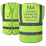
JKSafety 9 Pockets Class 2 High Visibility Zipper Front Safety Vest With Reflective Strips,HQ Breathable Mesh,Meets ANSI/ISEA Standards(X-Large, Drone-Yellow)
KINBON Drone Landing Pads, Waterproof 30'' Universal Landing Pad Fast-fold Double Sided Quadcopter Landing Pads for RC Drones Helicopter DJI Spark Mavic Pro Phantom 2/3/4 Pro Inspire 2/1 3DR Solo

Hoodman Drone Landing Pad (3 Ft. Diameter)
DJI High Capacity Phantom 4 Series P4-Intelligent Flight Battery, White (CP.PT.000601) (Renewed)

DJI Mavic 2 Intelligent Flight Battery Replacement for Mavic 2 Zoom, Mavic 2 Pro Drone Quadcopter 3850mAh Accessory