
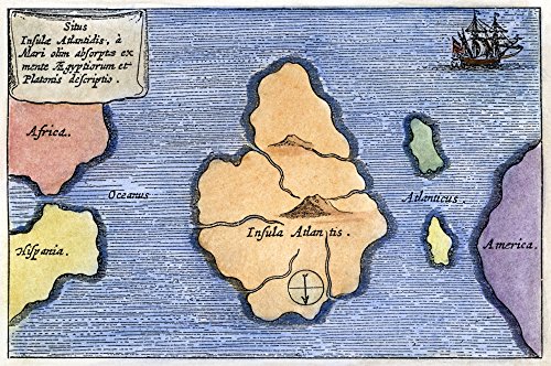
Map Of Atlantis 1678 Natlantis As A Very Large Island Midway Between The Pillars Of Hercules And America Is Depicted In This Map From Athanasius KircherS Mundus Subterraneus 1678 Poster Print by (18
Product Description
Map Of Atlantis 1678 Natlantis As A Very Large Island Midway Between The Pillars Of Hercules And America Is Depicted In This Map From Athanasius KircherS Mundus Subterraneus 1678 Poster Print by (18
- Map Of Atlantis 1678 Natlantis As A Very Large Island Midway Between The Pillars Of Hercules And America Is Depicted In This Map From Athanasius KircherS Mundus Subterraneus 1678
Technical Specifications
You might also like

Sporti Women's Textured Scoop Back One Piece Slimsuit - Black/Deep Sea - 6
Sporti Women's Textured One Piece Slimsuit - Raspberry/Denim Blue - 8

Sporti Women's Textured Front Twist One Piece Slimsuit - Black/Deep Sea - 6

Sporti Textured Chlorine Resistant Scoop Back One Piece Slimsuit - Black - 6

Sporti Women's Textured Scoop Back One Piece Slimsuit - Black/Teal - 6

Deltana OK2015CR003-R Solid Brass 2-Inch x 1/2-Inch Olive Knuckle Hinge

Deltana OK2015U3UNL-R Solid Brass 2-Inch x 1/2-Inch Olive Knuckle Hinge

Deltana OK2520U14-L Solid Brass 2 1/2-Inch x 2-Inch Olive Knuckle Hinge