

Datums and Map Projections: For Remote Sensing, GIS and Surveying, Second Edition
Product Description
Datums and Map Projections: For Remote Sensing, GIS and Surveying, Second Edition
- Used Book in Good Condition
Technical Specifications
You might also like

Signature Design by Ashley Mahoney Contemporary Oversized Accent Ottoman, Light Gray

Coliao 4pcs DC Motor Speed Controller PWM 5V-16V 12V 10A Voltage Regulator DC Motor Governor Stepless Speed Regulator LED Dimmer Power Controller

Floral Print Tiered Aqua Prom Dresses 2026 with Slit Long US18W
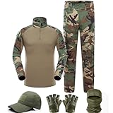
VPZenar Men's Tactical Uniform,Combat Shirt & Pants,WLD Airsoft Clothes,M

SUPERIOR Cotton Face Towel/Washcloth Set of 12, Daily Use for Bathroom, Guest Bath, Quick Dry Small Towels, Face, Hand, Gym, Spa, Hotel, Absorbent, Essentials, Ribbed, Soho Collection, Plum

FANDAMEI Hair Donut Bun Maker Kit - 4 Hair Bun Maker, 20 Invisible Hair Nets for Buns, 5 Elastics, 20 Bobby Pins, Bun Nets for Ballet girls,Hair Donuts for Buns - Tan Brown

Plastic Clothes Hangers – Heavy Duty Hanger Set, for Organizing Clothes, Dresses, and Coat, Holds Up to 5 lbs, Space-Saving Hangers with Non-Slip Shoulder Grooves, Pack of 80, Red

E-Serials Collection Management