

Cambell River to Port Hardy: (Discover Passage; Johnstone Strait; Queen Charlotte Stait)
Product Description
Cambell River to Port Hardy: (Discover Passage; Johnstone Strait; Queen Charlotte Stait)
- 2-sided waterproof, tear-resistant map which folds to 9" x 4" and unfolds to 3'x 2'
- 20-meter underwater depth contours
- Fish habitat identified including kelp weedbeds and rocky reefs
- Fishing Locations
- Numerous GPS Coordinates
- Navigational aids including bouys, lights, latitude and longitude grids
- Boat ramps, marinas, government docks, roads, campgrounds and facilities identified
- MADE IN THE U.S.A.
Technical Specifications
You might also like

Corgi Toys CD54321062 107 - Bat Boat With Batman & Robin figures and Die - Cast Trailor special Trailor coupling to fit Batmobile RT26701 1:46 Scale Souvenir Gift for men or women

Schwin Resistance Gear Servo Motor Brake Tensioner 1000511269 Replacement Resistance Control Motor for Recumbent Bike and Elliptical Trainer Models Fitness Equipment Repair Part

per 10" Round Professional-Grade (HVAC Zoning) - Preminum replacement for Honeywell, EWC, Durozone, more (10)

DEZ FURNISHINGS Cordless 1.5" Light Filtering Cellular Shade, 31.5" W x 48" H, Latte

17 1/2"W x 55"H Americraft Five Board (2 Batten) Exterior Real Wood Joined Board-n-Batten Shutters w/Elliptical Top (Per Pair), Colorful Leaves
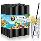
200 Pack Black Disposable Plastic Straws, 10.5" Extra Long Drinking Straws, 0.23" Diameter BPA-Free Straws for 30oz Tumblers, Tall Glasses, Iced Coffee and Party Use

Difeel Rehydrate Leave in Conditioning Treatment - 100% Pure Argan Oil 6 oz. with Spray Cap & Dispensing Cap

RACO 2903RT Steel EMT Compression Connector, Rain Tight, 3/4" (Pack of 25)